Monday, March 20, 2017

WEDNESDAY, MARCH 15, TRIP TO SADDLE ROAD, HILO, BACK TO WAIMEA

We decided to drive to Hilo using the saddle road which runs between Mauna Loa and Mauna Kea.  The weather in Kona was a bit iffy, so we decided if the road seemed clear we'd try it.  Fortunately, it was gorgeous!

Driving out of Kona there were a couple of gas stations, which we drove past.  Charlie was sure there'd be more.  No.  So we went back to Waimea (a 20 minute detour), got gas and got on the saddle road.
You can see Waimea nestled at the base of the hill to the far right.

A view of Mauna Kea from the belt highway.

A closer look at Waimea

On the road toward Mauna Kea.  Cinder cone in the foreground

Better view of the cinder cone.

Mauna Loa from the saddle road.  Both huge volcanoes had snow on top.

View of the saddle road.

We took a side trip up to the Keck Observatory.  The building shown here is the information center.  It's located at about 8500 feet in altitude, and we couldn't go any higher without a four wheel drive vehicle.  Our poor little rental car wasn't too happy with 8500 feet. The Mauna Kea peak is about 13,796 feet.  Mauna Loa is about 13, 250 feet. 

The photos below are of Charlie and me near the information center.


This is a Silver Sword.  It grows on the upper slopes of Mauna Kea.

The trip back down was fascinating.  Part of the road had an incline of 17%.  If you look carefully at the photo below, you can see the saddle road hiding in the darker green.


Mauna Loa from the saddle road.

In Hilo we went to the Wailoa River State Park for lunch.  Trying to find a toilet, we wandered into the Wailoa Center.  An interesting building that puts on exhibitions.  This one focused on art works made from Hawaiian wood.  What a great and beautiful find!  


View of Mauna Kea from the park in Hilo.  I'd been to Hilo three times and never knew you could see the volcano from here because if was always too cloudy.

Nifty bird on the lawn near the Waimea building

We took a four mile scenic drive after lunch.

A view of Hilo from the scenic road.

Some of what made the scenic road scenic.

At the end of the scenic road was another wonderful old-Hawaiian town.  Pepe'ekeo


Akaka falls.  It was beginning to really cloud over so our photos became less spectacular.  The falls are in a state park, and the rangers had knocked down several trees which had blocked half the path to the falls.  We could only walk one way and return the same way.  When we asked why, the told us the trees weren't indigenous and falling branches made them dangerous.  Apparently so.  The tree falls themselves did a great deal of damage to the trail.

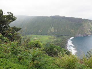
Our final stop was Wailoa Valley.  The clouds were beginning to really coming in, and it was beginning to rain.  We could still get a shot of the valley from the rim, but any thoughts of hiking down to it evaporated.  The Wailoa Valley was apparently very special to the Hawaiian kings.

The photo above was taken from the airplane flying out of Kona back to LAX.  My favorite view on the big island, Mauna Kea covered in snow.

Sunday, March 19, 2017

TUESDAY, MARCH 14, SPINNER DOLPHINS - NO WHALES IN SIGHT.

Monday night Charlie and I walked the main drag of Kailua Kona.  Near the Kona Island Inn restaurant was a tour office.  We decided to try to whale watch.  The season is supposed to be from late December until April.  So, this morning, after a very leisurely breakfast and lunch pack-up, we drove to the place to catch the catamaran for the whale watch.  Since we are always early, we spent time along the docks to have lunch.


Charlie outside our condo in Kailua Kona.  

Another view of Kailua Kona across the street from our condo.  Sigh, if the place were only as nice as the view. : (

During lunch we managed to see great red headed birds hopping along the dock.  In the water we saw Eagle Spotted rays - a lot of them.


The boat basin

There's a turtle in the water.  By the time I pulled my camera out - he looked like flotsam -

Near the boat basin is a research center that specializes in marine studies.  A view of the center.

The center and waves along the shore.

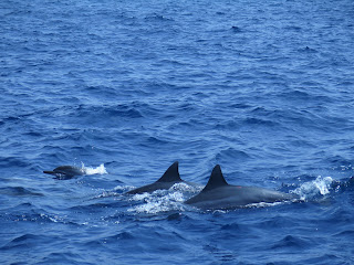
Just off the research center we spotted some spinner dolphins.  I'd heard about them, but never saw them in action before.
The photo above is a spinner dolphin in action.  He jumped out of the water three times while we watched, spun really quickly, then plopped back into the water.  A real show-man (show dolphin?)

They move quickly, here are a few photos of the spinner dolphins near the boat.


The triangular object above is a fish farm.  The fish are in the open water so there is less pollution for the fish - and the people eating them


After the dolphin excitement - we were skunked. We sailed around a bit - but all the whales kept below.  Since we didn't see any whales - we got a coupon for another trip - any time we come back to see whales.  No whales - you get a rebate.

Our disappointed guide on her catamaran

We stopped at a local Safeway to buy water for lunch - Safeway chickens - who knew?


MARCH 13 - A VISIT TO KILAUEA

We got up, ate our condo breakfast (Cheerios and/or English muffins), packed our PBJ sandwiches, and off we drove toward Hawaii Volcanoes National Park.  We expected rain, but the day turned out to be lovely.  The drive from Kona to the park is the longest one we could take on the island (2 hours each way).  Some lovely scenery, but a long drive.  Once we got beyond the Kona coast, most of the island is very rural.  The farms were mostly macadamia nut farms, and, possibly, some coffee farms as well.  The entire ride was along the slopes of, what I was later to find out, was Mauna Loa.  Factoid:  It's one of the largest volcanoes in the world - not tallest - just widest - it takes up a lot of territory.  The road was steep on both sides - one up the other spectacularly steep downwards.

Our first stop was the Thurston Lava tube.  We took a half mile walk through the jungle to the tube.  Both the walk and the tube were great.
Charlie beginning our walk


Kilawuea-iki crater from the trail.

Inside the tube.

The tube is huge - I'm in the photo for scale.

Lovely trail to and from the tube.

Our next tour was the Chain of Craters road.  Due to caution and recent eruptions  the mile trail was reduced to 0.4 mi.  Oh well.  The photos below were what we were able to see.


Along the highway were a number of stops to look at old calderas.  The one below is from a 1974 eruption.  Note the lava flow into the caldera lake.


The caldera below is the Pu'u Pua'i caldera - about 1979.  Note the trees above are full sized - the crater was amazingly deep.


Puhoehoe lava along the road.  (This is ropey looking lava).  The other kind is ahaa - lava chuncks.  Behind me was a trail, of a sort, that led down to the water (about 10 miles).  The trail was supposed to be marked by cairns.  Since piles of ahaa lava look like cairns, I'm sure I'd get hopelessly lost.

This photo was a view of the ocean from the road.  We stopped and had lunch with this lovely view.

The two photos below are of steam rising from the ocean where the newest lava is flowing into the sea.  We couldn't get anywhere close.  Again, precaution, road blocks, and some real potential danger.  Piles of the new lava build up, then collapse.  Other than a helicopter, there really wasn't any way to see this close up.


We opted for a 0.7 mile walk to the Pu'u Loa petroglyphs.  The trail was all lava flow which made it interesting - like walking up and down loads of little steps.


Steam vents are seen in the photo below.  These are very close to the visitor center


Across the street from the visitor center is the Volcano House.  A hotel that sits right at the edge of the Kilauea crater.  The photo below was taken from the porch of the hotel.