We had another wonderful breakfast. The fruit was great, the bread was great, fresh lox - I'm going to be charged extra weight for me coming home.
Lazarus picked us up a little before 9 AM and we began our journey around Cape of Good Hope. Our first stop - Rocklands Bay. There was a sign designating the place where volcanic intrusions went into an old sea floor. It's eroded down to the granite batholith and you can see evidence of an old volcanic region as well as the sedimentary layers on top (e.g. Table Mountain). (lots of round bays that look like former caldera). Darwin landed at this point and understood the geology of the place. The photo below is the volcanic intrusion


After we visited the Cape of Good Hope we drove to Boulder's Penguin Colony (between Simon's Town and Cape Point). The African Penguins were nearly extinct. Two breeding pairs were saved and over 2500 penguins are in the colony today. They live on land and totter into the ocean to eat. What a funny bunch. I went photo crazy.


Our last stop was at the Cecil Rhodes Botanical Gardens. The setting of the place was spectacular, and the gardens were beautiful.


Lazarus picked us up a little before 9 AM and we began our journey around Cape of Good Hope. Our first stop - Rocklands Bay. There was a sign designating the place where volcanic intrusions went into an old sea floor. It's eroded down to the granite batholith and you can see evidence of an old volcanic region as well as the sedimentary layers on top (e.g. Table Mountain). (lots of round bays that look like former caldera). Darwin landed at this point and understood the geology of the place. The photo below is the volcanic intrusion


There are huge kelp forests along the coast.

Sandybay. The water was an amazing color. The twelve apostles are the cliffs behind the bay (they are part of the back end of Table Mountain) Table Mountain looks like a huge mesa from Cape Town itself, but is not mesa-like from any other angle.

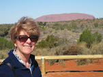
Charlie at Southbay.

The wind was really blowing so hard that along part of the coast the white caps were blown out. The sea looked like it was covered in snow - my photo doesn't do that justice

Houtbay. Another beautiful beach area which was more commercial than the others that we had seen.

The valley leading to Houtbay (on the left of the peak in the middle) was the main part of the residential area. To the right as we drove along were expensive homes, most of which were surrounded by fencing which advertised security systems in place from several different companies. Then there was a golf course. Literally across the road from the golf course was a dismal slum. There was no transitional area in between. Golf course and luxury to the right - slum to the left. Several men were standing in groups along the main road. Lazarus told us that they were hoping for day-work. We didn't have to be told. These men looked like the guys outside of U-Haul.

Boat trips led out of Houtbay to look at fur seals. The boat in the photo above went out to the opening of the bay and then turned around. As I mentioned the wind was howling today.

Noordhoek Beach. The interesting thatched roof was a building in a resort along the near side of the beach. It was another amazingly beautiful area. Note the beach plants in a small circle that overlap the curve of the beach.

The dot to the upper right of the beach plants is a horse and rider. This beach was huge.

The topography between the beach and the mountains on the way to Cape of Good Hope.

Mast Bay. Again, note the small double dots. Those are humans watching the water. These bays were huge.

Cliffs near Cape Point. This one was northwest of the cape.

The light house at the Cape of Good Hope at Cape Point. Charlie and I took a funicular to the base of the light house cliff. We climbed up the rest of the way. Obviously, this was a very popular spot for tourists.

The same beach from the photo before the last - from higher above the cliffs.

Charlie and I in the same location

A very quiet lizard along the path.

Looking out to Cape Point

Antelopes that are unique to this region of South Africa. We were in the Cape of Good Hope Nature Reserve.

Ostriches along the road.

Charlie and I at the Cape of Good Hope itself. Today was windy, and it was remarkably windy along the coast.

Another ostrich. Note his disarrayed feathers from the wind.


A baby

Notice how they are lying flat. Apparently this is a penguin position when the wind is blowing very hard. The wind was so fierce, we were getting pelted by sand. My penguin viewing experiences have been meteorological challenges as well. When we were along the Beagle Channel near Cape Horn it was snowing with a howling wind, and the penguins were in their hunker down or die position there too.

These two refused to be laid low by a gale!

This fellow was another upright soul.

This guy walking along the beach was a real hoot

Another baby. The babies kept their backs to the wind.

Giving me the "get lost" look.
Our last stop was at the Cecil Rhodes Botanical Gardens. The setting of the place was spectacular, and the gardens were beautiful.

Me in the gardens. The Devil's Peak is in the back to the right.

A large stage was set along a grassy area for concerts.

A variety of ibis.

This tree top bridge was called the Boomslang Bridge after the snake of the same name. Very beautiful walk.

The section of Cape Town that was around the corner from Table Mountain. The airport is on this side of town.

Proteas grow all over this region of South Africa.

The National Flower of South Africa (Protea Cynaroides) or King Protea. The center looks a lot like an artichoke.

The mountains changed every time we looked at them.

Another lovely protea

A guinea fowl. It didn't take off because there were chicks around.
No comments:
Post a Comment